| Assessment Year |
Reason |
Total Land |
Cap 1 Land |
Cap 2 Land |
Cap 2 Ag Land |
Cap 2 LTC Land |
Cap 3 Land |
Total Improv. |
Cap 1 Improv. |
Cap 2 Improv. |
Cap 2 LTC Improv. |
Cap 3 Improv. |
Total Value |
| 2025 |
Annual Adjustment |
$6,000.00 |
$6,000.00 |
$0.00 |
$0.00 |
$0.00 |
$0.00 |
$46,600.00 |
$46,600.00 |
$0.00 |
$0.00 |
$0.00 |
$52,600.00 |
| 2024 |
Annual Adjustment |
$6,000.00 |
$6,000.00 |
$0.00 |
$0.00 |
$0.00 |
$0.00 |
$37,900.00 |
$37,900.00 |
$0.00 |
$0.00 |
$0.00 |
$43,900.00 |
| 2023 |
Annual Adjustment |
$5,500.00 |
$5,500.00 |
$0.00 |
$0.00 |
$0.00 |
$0.00 |
$23,900.00 |
$23,900.00 |
$0.00 |
$0.00 |
$0.00 |
$29,400.00 |
| 2022 |
Annual Adjustment |
$3,800.00 |
$3,800.00 |
$0.00 |
$0.00 |
$0.00 |
$0.00 |
$25,200.00 |
$25,200.00 |
$0.00 |
$0.00 |
$0.00 |
$29,000.00 |
| 2021 |
Annual Adjustment |
$3,700.00 |
$3,700.00 |
$0.00 |
$0.00 |
$0.00 |
$0.00 |
$22,500.00 |
$22,500.00 |
$0.00 |
$0.00 |
$0.00 |
$26,200.00 |
| 2020 |
Annual Adjustment |
$3,700.00 |
$3,700.00 |
$0.00 |
$0.00 |
$0.00 |
$0.00 |
$22,500.00 |
$22,500.00 |
$0.00 |
$0.00 |
$0.00 |
$26,200.00 |
| 2019 |
Annual Adjustment |
$3,700.00 |
$3,700.00 |
$0.00 |
$0.00 |
$0.00 |
$0.00 |
$22,200.00 |
$22,200.00 |
$0.00 |
$0.00 |
$0.00 |
$25,900.00 |
| 2018 |
Annual Adjustment |
$4,100.00 |
$4,100.00 |
$0.00 |
$0.00 |
$0.00 |
$0.00 |
$24,700.00 |
$24,700.00 |
$0.00 |
$0.00 |
$0.00 |
$28,800.00 |
| 2017 |
Annual Adjustment |
$4,100.00 |
$4,100.00 |
$0.00 |
$0.00 |
$0.00 |
$0.00 |
$25,100.00 |
$25,100.00 |
$0.00 |
$0.00 |
$0.00 |
$29,200.00 |
| 2016 |
Annual Adjustment |
$4,100.00 |
$4,100.00 |
$0.00 |
$0.00 |
$0.00 |
$0.00 |
$26,300.00 |
$26,300.00 |
$0.00 |
$0.00 |
$0.00 |
$30,400.00 |
| 2015 |
Annual Trending |
$5,100.00 |
$5,100.00 |
$0.00 |
$0.00 |
$0.00 |
$0.00 |
$34,900.00 |
$34,900.00 |
$0.00 |
$0.00 |
$0.00 |
$40,000.00 |
| 2014 |
Annual Trending |
$5,100.00 |
$5,100.00 |
$0.00 |
$0.00 |
$0.00 |
$0.00 |
$41,600.00 |
$41,600.00 |
$0.00 |
$0.00 |
$0.00 |
$46,700.00 |
| 2013 |
Annual Trending |
$5,100.00 |
$5,100.00 |
$0.00 |
$0.00 |
$0.00 |
$0.00 |
$40,300.00 |
$40,300.00 |
$0.00 |
$0.00 |
$0.00 |
$45,400.00 |
| 2012 |
GENERAL REVALUATION |
$5,100.00 |
$5,100.00 |
$0.00 |
$0.00 |
$0.00 |
$0.00 |
$39,900.00 |
$39,900.00 |
$0.00 |
$0.00 |
$0.00 |
$45,000.00 |
| 2011 |
Annual Trending |
$5,100.00 |
$5,100.00 |
$0.00 |
$0.00 |
$0.00 |
$0.00 |
$38,200.00 |
$38,200.00 |
$0.00 |
$0.00 |
$0.00 |
$43,300.00 |
| 2010 |
Annual Trending |
$5,400.00 |
$5,400.00 |
$0.00 |
$0.00 |
$0.00 |
$0.00 |
$36,900.00 |
$36,900.00 |
$0.00 |
$0.00 |
$0.00 |
$42,300.00 |
| 2009 |
Annual Trending |
$4,700.00 |
$4,700.00 |
$0.00 |
$0.00 |
$0.00 |
$0.00 |
$37,800.00 |
$37,800.00 |
$0.00 |
$0.00 |
$0.00 |
$42,500.00 |
| 2008 |
Annual Trending |
$4,800.00 |
$4,800.00 |
$0.00 |
$0.00 |
$0.00 |
$0.00 |
$38,600.00 |
$38,600.00 |
$0.00 |
$0.00 |
$0.00 |
$43,400.00 |
| 2007 |
Informal |
$4,500.00 |
$0.00 |
$0.00 |
$0.00 |
$0.00 |
$4,500.00 |
$30,800.00 |
$0.00 |
$0.00 |
$0.00 |
$30,800.00 |
$35,300.00 |
| 2006 |
Informal |
$4,100.00 |
$0.00 |
$0.00 |
$0.00 |
$0.00 |
$4,100.00 |
$27,700.00 |
$0.00 |
$0.00 |
$0.00 |
$27,700.00 |
$31,800.00 |
| 2005 |
GENERAL REVALUATION |
$4,100.00 |
$0.00 |
$0.00 |
$0.00 |
$0.00 |
$4,100.00 |
$11,400.00 |
$0.00 |
$0.00 |
$0.00 |
$11,400.00 |
$15,500.00 |
| 2004 |
GENERAL REVALUATION |
$4,100.00 |
$0.00 |
$0.00 |
$0.00 |
$0.00 |
$4,100.00 |
$11,400.00 |
$0.00 |
$0.00 |
$0.00 |
$11,400.00 |
$15,500.00 |
| 2003 |
GENERAL REVALUATION |
$4,100.00 |
$0.00 |
$0.00 |
$0.00 |
$0.00 |
$4,100.00 |
$11,400.00 |
$0.00 |
$0.00 |
$0.00 |
$11,400.00 |
$15,500.00 |
| 2002 |
GENERAL REVALUATION |
$4,100.00 |
$0.00 |
$0.00 |
$0.00 |
$0.00 |
$4,100.00 |
$11,400.00 |
$0.00 |
$0.00 |
$0.00 |
$11,400.00 |
$15,500.00 |
|
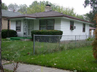

_45-08-34-153-003.000-004.JPG)